

|
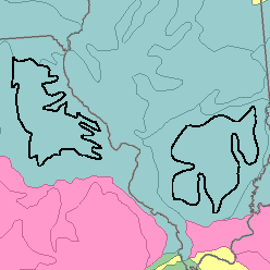
MLRA 113 - Central Claypan AreasIllinois and Missouri28,670 km2 (11,030 mi2) |

|
Elevation and Topography:
Elevation ranges from 200 to 300 m in Missouri and is about 200 m in Illinois, increasing gradually from south to north in both states. This MLRA consists of nearly level to gently sloping silt-mantled old till plains. Stream valleys are shallow, and most of them are narrow. Local relief is mainly a few meters.
Soil Landscapes | Soil Climates | Soil Datasets | Personnel | Site Map
Comments and Questions
12/16/98