

|
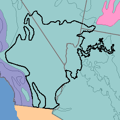
MLRA 30 - Sonoran Basin and RangeArizona, California, and Nevada194,030 km2 (74,910 mi2) |

|
Land Use:
About four-fifths of this area is federally owned. Much of the remainder is owned by local governments. Most of the land has a cover of desert vegetation. The area is used only locally for grazing because of the low forage production and the lack of water for livestock. On sites intensively used for recreation, especially where motorcycles and off-road vehicles are driven, the hazards of wind and water erosion are severe.
Soil Landscapes | Soil Climates | Soil Datasets | Personnel | Site Map
Comments and Questions
12/16/98