

|
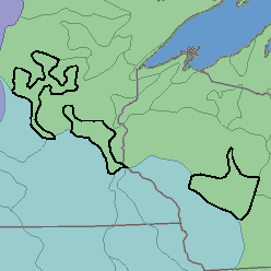
MLRA 91 - Wisconsin and Minnesota Sandy OutwashMinnesota and Wisconsin52,780 km2 (20,380 mi2) |

|
Land Use:
About 90 percent of this area is in farms. About 10 percent, mostly in Wisconsin, is state and federally owned. Nearly one-third of the area is cropland. Feed grains and forage for livestock are the main crops, but truck crops are also important. Potatoes and canning crops such as snap beans, peas, and corn are commonly grown under irrigation. Cranberries are grown on some wet soils. About one-tenth of the area is forested and used mainly for pulp and timber production. These forested areas and associated lakes and streams provide recreation facilities. Controlling soil blowing and conserving moisture on sandy soils, improving drainage on wet soils, and maintaining soil fertility are major concerns of management.
Soil Landscapes | Soil Climates | Soil Datasets | Personnel | Site Map
Comments and Questions
12/16/98