


|
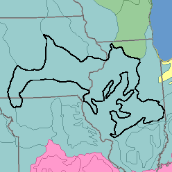
MLRA 108 - Illinois and Iowa Deep Loess and DriftIllinois, lowa, and Missouri79,790 km2 (30,800 mi2) |

|
Elevation and Topography:
Elevation ranges from 200 m on the lowest valley floors to 300 m on the highest uplands, increasing gradually from east to west. Much of this dissected loess-mantled glacial plain is rolling to hilly, but some of the broad uplands far from the large streams are level to undulating. The smaller streams have narrow valley floors, but the large streams have broad flood plains. Local relief is mainly several meters to 25 or 50 m, but the upland flats have relief of only 1 or 2 m.
Soil Landscapes | Soil Climates | Soil Datasets | Personnel | Site Map
Comments and Questions
12/16/98