

|
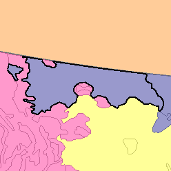
MLRA 52 - Brown Glaciated PlainMontana52,110 km2 (20,120 mi2) |

|
Elevation and Topography:
Elevation generally ranges from 600 to 1,400 m, increasing from east to west, but it is as much as 2,100 m in the Sweetgrass Hills. This glaciated plain is nearly level to gently rolling, but belts of steep slopes border some of the larger rivers. The Milk River has extensive flood plains, but flood plains along the other streams are narrow and discontinuous.
Soil Landscapes | Soil Climates | Soil Datasets | Personnel | Site Map
Comments and Questions
12/16/98