

|
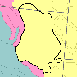
MLRA 58B - Northern Rolling High Plains, Southern PartMontana and Wyoming50,810 km2 (19,620 mi2) |

|
Elevation and Topography:
Elevation generally ranges from 900 to 1,800 m, increasing gradually from north to south, but in a few buttes it is as high as 2,100 m. These dissected plains are underlain by shale and sandstone. Slopes are mostly gently rolling to steep, and wide belts of steeply sloping badland border a few of the larger river valleys. Local relief is mainly in tens of meters. In places, flat-topped, steep-sided buttes rise sharply above the general level of the plain.
Soil Landscapes | Soil Climates | Soil Datasets | Personnel | Site Map
Comments and Questions
12/16/98