

|
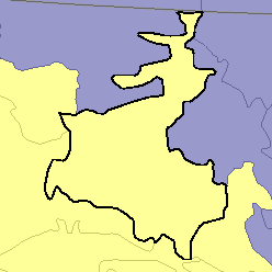
MLRA 63A - Northern Rolling Pierre Shale PlainsSouth Dakota29,610 km2 (11,430 mi2) |

|
Elevation and Topography:
Elevation ranges from 400 to 500 m on the bottom land of the Missouri River to 500 to 900 m on the shale plain uplands. The areas that are cropped are mainly at elevations of about 500 to 800 m. These areas are nearly level to rolling and have long smooth slopes and a well-defined dendritic drainage system. River and creek valleys have smooth floors and steep walls.
Soil Landscapes | Soil Climates | Soil Datasets | Personnel | Site Map
Comments and Questions
12/16/98