


|
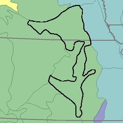
MLRA 75 - Central Loess PlainsKansas and Nebraska34,840 km2 (13,450 mi2) |

|
Elevation and Topography:
Elevation ranges from 500 to 600 m, increasing from east to west. Most of these nearly level to gently rolling plains are mantled by loess, but the part south of central Kansas is underlain by unconsolidated sediments, soft sandstone, and shale. The present drainage pattern cuts into the upper loess mantle and in places exposes the older Loveland loess. Stream valleys are mostly narrow and are not deeply incised. Relief is in meters to tens of meters.
Soil Landscapes | Soil Climates | Soil Datasets | Personnel | Site Map
Comments and Questions
12/16/98