

|
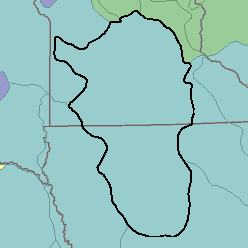
MLRA 103 - Central Iowa and Minnesota Till PrairiesIowa and Minnesota71,990 km2 (27,800 mi2) |

|
Land Use:
Nearly all this area is in farms, and about three-fourths is cropland. The proportion of cropland is highest in the southern part of the area. Corn, soybeans, and other feed grains are major crops. Some cropland is used for hay. Dairy farming is an important enterprise in the north. Between 10 and 15 percent of the area is permanent pasture. Narrow bands of woodland on steep slopes border stream valleys, and some of the wet bottom land is also forested. About 5 percent of the area is used for urban development, and a similar proportion is used for other purposes.
Soil Landscapes | Soil Climates | Soil Datasets | Personnel | Site Map
Comments and Questions
12/16/98