

|
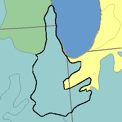
MLRA 110 - Northern Illinois and Indiana Heavy Till PlainIllinois, Indiana, and Wisconsin26,350 km2 (10,170 mi2) |

|
Land Use:
Most of this area is in farms, but about 25 percent in the north, consisting of Chicago and its suburbs, is used for urban development. Some land formerly used for crops is rapidly becoming urbanized. Farmed areas are used mainly for cash-grain crops. Corn and other feed grains are the principal crops. Woodland occupies less than 5 percent of the area and is mainly on wet flood plains, on steeply sloping valley sides, and on morainic ridges. Controlling wetness, erosion, flooding, and sedimentation are major concerns of management in both urban and farm areas.
Soil Landscapes | Soil Climates | Soil Datasets | Personnel | Site Map
Comments and Questions
12/16/98