


|
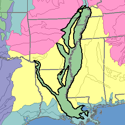
MLRA 131 - Southern Mississippi Valley AlluviumArkansas, Mississippi, Missouri, and Tennessee93,600 km2 (36,140 mi2) |

|
Land Use:
Most of this area is in farms. About 55 percent is cropland, 35 percent woodland, and 7 percent pasture. About 3 percent is used for miscellaneous purposes. Cropland makes up about three-fourths of the acreage in the north and less than one-fourth in the south. The proportion of forest land varies inversely with that planted to crops; the proportion of pasture is a little higher in the south. This is an important cash-crop area. Soybeans, cotton, and wheat grown by highly mechanized methods are the major crops throughout the area. Corn is an important crop in Missouri. Rice is an important crop in Arkansas, Louisiana, and Mississippi, and sugarcane is important in southern Louisiana. Controlling surface water and artificially draining the wet soils are major concerns of management.
Soil Landscapes | Soil Climates | Soil Datasets | Personnel | Site Map
Comments and Questions
12/16/98