

|
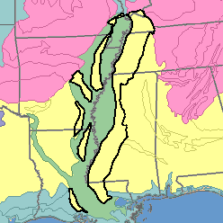
MLRA 134 - Southern Mississippi Valley Silty UplandsArkansas, Kentucky, Louisiana, Mississippi, and Tennessee51,410 km2 (19,850 mi2) |

|
Land Use:
Most of this area is in farms; a small acreage is federally owned. About 35 percent of the area is cropland, but the proportion varies greatly from county to county, depending on the soils and the topography. This is largely a cash-crop area. Cotton, corn, soybeans, and wheat are major crops, but rice is important locally in Arkansas and in Louisiana, and strawberries are important in Louisiana. Feed grains and forage are grown on dairy farms. About 16 percent of the area is in pasture or hay. About 46 percent is in forest of mixed pine and hardwoods. Lumber is the major forest product, and some pulpwood is harvested. The present trend is toward the conversion of the pasture and forest to cropland. About 3 percent of the area is used for urban development or other purposes. There is an increase in urban development near the metropolitan areas.
Soil Landscapes | Soil Climates | Soil Datasets | Personnel | Site Map
Comments and Questions
12/16/98