

|
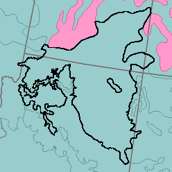
MLRA 35 - Colorado and Green River PlateausArizona, Colorado, and Utah123,350 km2 (47,630 mi2) |

|
Elevation and Topography:
In most places, elevation is 1,300 to 1,500 m. Mt. Trumbull, on the north rim of the Grand Canyon, however, is 2,400 m high, and the Navajo Mountain, on the Utah-Arizona state line, is 3,200 m. In general, the surface consists of gently sloping to strongly sloping plains. Volcanic plugs that rise abruptly above the plains, steep scarps, or deeply incised canyons interrupt the plain surface. The Painted Desert, Vermillion and Echo Cliffs, Glen Canyon Recreational Area, and Canyonlands National Park are included.
Soil Landscapes | Soil Climates | Soil Datasets | Personnel | Site Map
Comments and Questions
12/16/98