

|
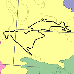
MLRA 64 - Mixed Sandy and Silty TablelandNebraska, South Dakota, and Wyoming28,400 km2 (10,970 mi2) |

|
Elevation and Topography:
Elevation ranges from 900 to 1,200 m, increasing gradually from east towest. The nearly level to gently sloping tableland south of the narrow, steep-walled valleys of Pine Ridge has the highest elevation. The topography north of the Pine Ridge escarpment is strongly sloping but becomes less sloping as distance from the escarpment increases. Local relief is mainly in meters, but at Pine Ridge relief is in tens of meters.
Soil Landscapes | Soil Climates | Soil Datasets | Personnel | Site Map
Comments and Questions
12/16/98