


|
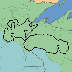
MLRA 90 - Central Wisconsin and Minnesota Thin Loess and TillMinnesota and Wisconsin55,750 km2 (21,530mi2) |

|
Elevation and Topography:
Elevation ranges from 300 to 500 m. Locally, the level to rolling till plains are mantled by loess. The topography is irregular; there are nearly level outwash plains and lacustrine basins, low hills and ridges, and many lakes and organic deposits in basins. Local relief is mainly a few meters, but some hills rise more than 50 m above the adjacent lowlands.
Soil Landscapes | Soil Climates | Soil Datasets | Personnel | Site Map
Comments and Questions
12/16/98