

|
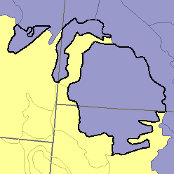
MLRA 54 - Rolling Soft Shale PlainMontana, North Dakota, and South Dakota58,100 km2 (22,430 mj2) |

|
Land Use:
Nearly all this area is in farms and ranches. In most places agriculture is a combination of livestock production and cash grain farming. About three-fifths of the area is in native grasses and shrubs that are grazed. The less sloping soils, making up about one-third of the total area, are dry-farmed. Wheat, other small grains, feed grains, hay, silage corn, and flax are the principal crops. Small tracts on the bottom land along the Missouri River and a few of its larger tributaries are irrigated.
Soil Landscapes | Soil Climates | Soil Datasets | Personnel | Site Map
Comments and Questions
12/16/98