

|
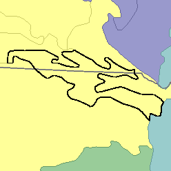
MLRA 66 - Dakota-Nebraska Eroded TablelandNebraska and South Dakota12,400 km2 (4,800 mi2) |

|
Elevation and Topography:
Elevation ranges from 600 to 900 m. The higher parts of the tableland are nearly level to moderately sloping, but steeper sections are on the sides of ridges and drainageways. Drainages are well defined except in some undulating areas where eolian sandy materials mantle the bedrock.
Soil Landscapes | Soil Climates | Soil Datasets | Personnel | Site Map
Comments and Questions
12/16/98