


Lambert Azimuthal Projection
Files for rock volume percent
Data set reference code -- 1997-0011
To accommodate users with a variety of GIS software, the data giving the rock volume percent are available in several different formats. The files needed by each of the types of user below are described separately.
- Arc/Info polygon file users
- Arc/Info grid file users
- Other users of gridded data
- Local users on the ESSC network
Arc/Info polygon file users
The orginal STATSGO mapunits for the 48 states have been merged into a single Arc/Info polygon (vector) coverage. The rock volume percent for each standard layer of each mapunit is given by the INFO table MU_ROCKVOL, which may be RELATEd to the mapunit coverage using "MUID" as the relate item. The needed files are
- mu_poly.e00.gz (116 Mbyte, uncompresses to 274 Mbyte)
- Mapunit polygon coverage in Arc/Info EXPORT format.
- mu_rockvol.e00.gz (185 kbyte, uncompresses to 759 kbyte)
- INFO table giving mean rock volume percent for each standard layer of each mapunit, in Arc/Info EXPORT format.
- stdlayer.e00
- INFO table defining the 11 standard soil layers for which the mean rock volume percent was computed.
Arc/Info grid file users
The mapunits have been gridded at 1-km cell size. The value attribute table (VAT) for the Arc/Info grid listed below contains the mapunit indentifier, MUID, the mapunit serial number, MUSERIAL, the mean depth to bedrock, ROCKDEPM, and the mean rock volume percent for each of the 11 standard soil layers.Warning -- The uncompressed version of the grid file below is very much larger than the compressed version.
- rockvolgrid.e00.gz (8 Mbyte, uncompresses to 122 Mbyte)
- 1-km grid giving rock volume percent, in Arc/Info grid format.
- stdlayer.e00
- INFO table defining the 11 standard soil layers for which the mean rock volume percent was computed.
Other users of gridded data
The 1-km gridded data are also available as a three-dimensional array of 8-bit unsigned binary integers. The data are organized as eleven two-dimensional layers, giving, respectively, mean rock volume percent for each of the 11 standard soil layers. Within each layer, the values are arranged by horizontal rows. All values for the first layer are given first, starting with the value for the left (western) end of the top (northern-most) row, and continuing left to right along the row. The data for the last row of the first layer are then followed by the top row of the second layer, and so on.Each layer of the array contains 2889 rows of 4587 values each. Code for reading the binary array is available in Fortran 77 and C.
Warning -- The uncompressed version of the BSQ file below is very much larger than the compressed version.
- rockvol.bsq.gz (17 Mbyte, uncompresses to 146 Mbyte)
- Three-dimensional array of 8-bit unsigned integer values for mean rock volume percent for each standard layer of each grid cell.
- mu_rockvol.ascii.gz (126 kbyte, uncompresses to 662 kbyte)
- Table giving, for each STATSGO mapunit, the mapunit ID, mapunit serial number, mean depth to bedrock in cm, and volumetric percent of rock.
- stdlayer.ascii
- Table defining the 11 standard soil layers for which the mean rock volume percent was computed.
Local users on the ESSC network
The file systems containing the datasets are cross-mounted on the local ESSC computer network. Local Arc/Info users may find it more convenient to copy necessary files directly to their own workspaces using the Arc/Info COPY and COPYINFO commands. The needed directories and files (under directory $DSREF/1997-0011/) are- rockvolgrid
- Arc/Info grid giving mean rock volume percent for each standard soil layer for each 1-km grid cell.
- ../mapunits/mu_poly
- Arc/Info coverage containing polygon version of mapunit boundaries.
- info!MU_ROCKVOL
- INFO table giving rock volume percent values for each mapunit.
- info!STDLAYER
- Table defining the 11 standard soil layers for which the mean bulk desnity was computed.
Last change: 2006 Apr 14, R. A. White / raw@essc.psu.edu
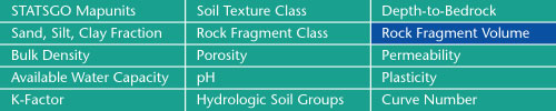
Sand, Silt, Clay Fractions | Rock Fragment Class | Rock Fragment Volume
Bulk Density | Porosity | Permeability
Available Water Capacity | pH | Plasticity
K-Factor | Hydrologic Soil Groups | Curve Numbers
Soil Landscapes | Soil Climates | Soil Datasets | Personnel | Site Map
Comments and Questions
3/8/2006