


The mean available water capacity for each STATSGO map unit was computed for three column lengths, 100, 150, and 250 cm, measured from the surface. These column lengths were chosen for the following reasons:
- A number of models use a root-zone depth of 100 cm;
- Bedrock information is only reliable to a depth of about 150 cm;
- 250 cm is the maximum depth for which data were available for any mapunits.
Many STATSGO Component table entries for depth-to-bedrock used 60 inches (152 cm) to indicate that bedrock was not encountered within this distance of the surface. In computing AWC, it was assumed that there was no water capacity below the specified depth-to-bedrock unless the STATSGO Layer table explicitly described soil layers extending below this depth. Accordingly, the computed AWC for a 250 cm column will often understate the actual value.
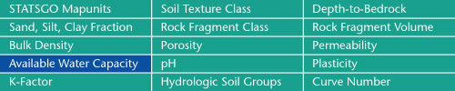
Sand, Silt, Clay Fractions | Rock Fragment Class | Rock Fragment Volume
Bulk Density | Porosity | Permeability
Available Water Capacity | pH | Plasticity
K-Factor | Hydrologic Soil Groups | Curve Numbers
Soil Landscapes | Soil Climates | Soil Datasets | Personnel | Site Map
Comments and Questions
4/19/99