


Determining the bulk density for each of a set of standard layers required three main steps:
- Computing the mean bulk density for each component layer.
- For each component, determining the contribution of each component
layer to the 11 standard layers.
- For each map unit, combining the contributions of all components to
compute the bulk density for each layer.
The mean bulk density for each layer was computed as the simple average of BDH and BDL. Some components included one or more layers with BDL = BDH = 0 which were below the mean depth to bedrock (the average of ROCKDEPL and RPCHDEPH); for these components, the mean bulk density was set equal to the particle density, PD.
To determine the contribution of each component of a given map unit to the standard layers, the layers defined in the Layer table for the component were compared with each standard layer. If the standard layer was entirely included within one of the component layers, the BD values for the layer were multiplied by the COMPPCT value to determine the weighted contribution of the component to the standard layer. If the standard layer overlapped two or more component layers, the BD values for each component layer were first weighted in proportion to the amount of overlap before multiplication by the COMPPCT value.
If the bottom of the last layer specified for the component was above the the bottom of the last standard layer (250 cm), the component layer was assumed to have the same BD and porosity as the next higher component layer down to the mean bedrock depth. Below this depth, BD was set equal to PD.
If the component was identified as "WATER", it was excluded from the computation of mean BD. Some components specified BDL = BDH = 0 for all layers. These components were also excluded.
After all components for the map unit were processed, the sum of the weighted contributions to each standard layer by all non-excluded components was divided by the sum of the COMPPCT values for the non-excluded components to determine the mean BD for each standard layer of the map unit.
Two major problems were encountered which affect the validity of the computed values.
- Many components specify ROCKDEPL = ROCKDEPH = 60 inches (152 cm)
inferring that the soil was not examined below this depth. In most cases,
bedrock is not actually present; nonetheless, the values of BD were
computed as if bedrock was encountered at this depth.
- A number of non-water components, and in some cases entire map
units, have BDL = BDH = 0 for all component layers, even though other
variables for the layer (e.g., texture) contradict the BD values. These
components were ignored in the computation of average values for the map
unit. If BDL = BDH = 0 for all non-water components for the map unit,
the BD value was set to 0. If the map unit is entirely water, BD was
set to zero.
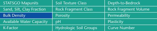
Sand, Silt, Clay Fractions | Rock Fragment Class | Rock Fragment Volume
Bulk Density | Porosity | Permeability
Available Water Capacity | pH | Plasticity
K-Factor | Hydrologic Soil Groups | Curve Numbers
Soil Landscapes | Soil Climates | Soil Datasets | Personnel | Site Map
Comments and Questions
4/19/99