


Albers Equal Area Projection
Files for mean depth to bedrock
Data set reference code -- 1996-0001
To accommodate users with a variety of GIS software, the data giving the mean depth to bedrock are available in several different formats. The files needed by each of the types of user below are described separately.
- Arc/Info polygon file users
- Arc/Info grid file users
- Other users of gridded data
- Local users on the ESSC network
Arc/Info polygon file users
The orginal STATSGO mapunits for the 48 states have been merged into a single Arc/Info polygon (vector) coverage. The mean depth to bedrock for each mapunit is given by the INFO table MU_ROCKDEPM, which may be RELATEd to the mapunit coverage using "MUID" as the relate item. The needed files are
- mu_poly.e00.gz (104 Mbyte, uncompresses to 249 Mbyte)
- Mapunit polygon coverage in Arc/Info EXPORT format.
- mu_rockdepm.e00.gz (66 kbyte, uncompresses to 209 kbyte)
- INFO table giving mean depth to bedrock for each mapunit, in cm, in Arc/Info EXPORT format.
Arc/Info grid file users
The mapunits have been gridded at 1-km cell size. The mean depth to bedrock for each grid cell may be downloaded as a single file:Warning -- The uncompressed version of the grid file below is very much larger than the compressed version.
- rockdepm.e00.gz (4.8 Mbyte, uncompresses to 113 Mbyte)
- 1-km grid giving mean depth to bedrock, in cm, in Arc/Info grid format.
Other users of gridded data
The 1-km gridded data are also available as a two-dimensional array of 8-bit binary values. The data are organized by horizontal rows, with the top (northern-most) row first, and the data for each row starting at the left (western) end of the row. The array contains 2896 rows of 4616 values each. Code for reading the binary array is available in Fortran 77 and C.The data are contained in a single file:
- rockdepm.bsq.gz (1.3 Mbyte, uncompresses to 13 Mbyte)
- Two-dimensional array of 8-bit unsigned integer values for mean depth to bedrock, in cm, for each grid cell.
Local users on the ESSC network
The filesystems containing the datasets are cross-mounted on the local ESSC computer network. Local Arc/Info users may find it more convenient to copy necessary files directly to their own workspaces using the Arc/Info COPY and COPYINFO commands. The needed directories and files (under directory $DSREF/1996-0001/) are- rockdepm
- Arc/Info grid giving mean depth to bedrock, in cm, for each 1-km grid cell.
- ../mapunits/mu_poly
- Arc/Info coverage containing polygon version of mapunit boundaries.
- info!MU_ROCKDEPM
- INFO table giving mean depth to bedrock for each mapunit, in cm.
Last change: 2006 Apr 14, R. A. White / raw@essc.psu.edu
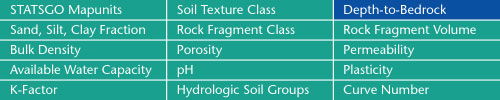
Sand, Silt, Clay Fractions | Rock Fragment Class | Rock Fragment Volume
Bulk Density | Porosity | Permeability
Available Water Capacity | pH | Plasticity
K-Factor | Hydrologic Soil Groups | Curve Numbers
Soil Landscapes | Soil Climates | Soil Datasets | Personnel | Site Map
Comments and Questions
3/8/2006