


The components of a given STATSGO mapunit are not necessarily all in the same HSG class. Since the location of a component within a map unit is not specified, it is only possible to determine the relative amounts (percent) of the different HSG classes over an entire mapunit. For any given point within the mapunit, these percent values may then be interpreted as the probabilities that the soil at that point is in each of the possible classes.
The computation of the percent of each HSG class in each mapunit used
the variables HYDGRP (HSG class) and COMPPCT (percent of the mapunit's
area covered by the component) from the STATSGO Component table.
Possible HYDGRP values include A, B, C, D, A/D, B/D, and C/D. The
percentage of each HSG class within each mapunit was calculated by totalling
the COMPPCT values for all components in that class; mixed classes (A/D,
B/D, and C/D) were converted to HSG D during processing. Since some mapunits
contain components which are all water, the percent of water for each mapunit was added as a fifth class, HSG W.
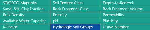
Sand, Silt, Clay Fractions | Rock Fragment Class | Rock Fragment Volume
Bulk Density | Porosity | Permeability
Available Water Capacity | pH | Plasticity
K-Factor | Hydrologic Soil Groups | Curve Numbers
Soil Landscapes | Soil Climates | Soil Datasets | Personnel | Site Map
Comments and Questions
4/19/99