


Determining the Plasticity Index for Standard Layers
The mean plasticity index was determined for each of 11 standard layers for each map unit of each state using data from the STATSGO Comp and Layer tables. The standard layers were introduced because of the wide variation in the number, thickness, and depth to top and bottom of soil layers in the STATSGO data from one soil component to another, even within the same map unit. Variable layers cause problems for many environmental models and GIS operations.Determining the mean plasticity index for the 11 standard layers required three main steps:
- Computing the mean plasticity index for each component
layer.
- For each component, determining the contribution of each component
layer to the 11 standard layers.
- For each map unit, combining the contributions of all components to
compute the mean plasticity index for each standard layer.
The Layer table variable TEXTURE1, which gives the dominant soil texture class for the layer, was also read; if it corresponded to neither mineral soil nor bedrock, (i.e., water, organic matter, or other), or if the component was identified as all water (COMPNAME = "WATER"), the component layer was excluded from the computation of mean plasticity. Approximatedly 11% of all component layers had no entries for PIH and PIL; in these cases, the plasticity index values were assumed to be zero. There were a total of 38 layers (0.01%) for which PIH and PIL were both zero or omitted and TEXTURE1 specified a clayey texture class (clay, clay loam, or silt clay loam) for which one would normally expect a non-zero plasticity index. For the eight cases in which the texture class was clay, it was accompanied by a rock-fragment modifier specifying an admixture of either gravel or shale. For the remaining 30 cases, the PIH and PIL values were omitted from the STATSGO record, and not specifically entered as zero. For texture classes having relatively little clay, the fraction of component layers with PIH/PIL zero or omitted generally increased as the amount of sand increased and the amount of clay decreased -- see the table, below.
The contributions of each component layer to the standard layers for a given map unit were determined using the component layer depths specified by Layer table variables LAYDEPL and LAYDEPH, the mean depth to bedrock for each component calculated by averaging Comp table variables ROCKDEPL and ROCKDEPH, and the percent of the area of the map unit covered by each component as specified by COMPPCT. For each component, the layers defined in the Layer table were compared with each standard layer in turn. If the standard layer was entirely included within one of the component layers, the plasticity index value for the layer was multiplied by the COMPPCT value to determine the weighted contribution of the component to the standard layer. If the standard layer overlapped two or more component layers, the plasticity index values for each component layer were first weighted in proportion to the amount of overlap before multiplication by the COMPPCT value. The region from the bottom of the last component layer to the bottom of the last standard layer, if any, was assumed to be the same as the lowest component layer down to the mean bedrock depth. Below this depth, the plasticity index was set to 0.
The weighted contributions of all components to each standard layer were then summed to obtain the mean plasticity index values for the map unit. If none of the component layers contributing to the standard layer were mineral soil or if the entire map unit was specified to be water, the plasticity index was set to zero.
NOTE that for many STATSGO components, a depth-to-bedrock value of 60 inches (152 cm) was used to indicate that the soil was not examined below this depth, and bedrock was not actually encountered. In all cases, however, the value of plasticity was computed as if bedrock was encountered at the depth specified by the mean of ROCKDEPL and ROCKDEPH. Accordingly, the plasticity index values for the two lowest standard layers (1.5 to 2.5 m) are, in many cases, misleadingly low.
The number of component layers having PIH/PIL values which are zero or omitted was tabulated for the six texture classes which do not contain "clay" in their names. The number of component layers for which the mean plasticity index is greater than zero was also tabulated, and the percent of layers with zero or omitted PI values was computed. The results are shown below:
| Texture | PI = 0 | PI > 0 | % zero | ||
|---|---|---|---|---|---|
| Loam | 601 | 61793 | 1.0 | ||
| Silt Loam | 841 | 57070 | 1.5 | ||
| Silt | 12 | 176 | 6.4 | ||
| Sandy Loam | 7763 | 52859 | 12.8 | ||
| Loamy Sand | 8750 | 2951 | 74.8 | ||
| Sand | 18325 | 3882 | 82.5 |
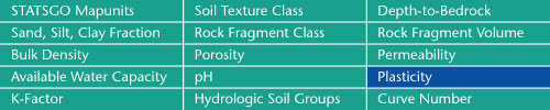
Sand, Silt, Clay Fractions | Rock Fragment Class | Rock Fragment Volume
Bulk Density | Porosity | Permeability
Available Water Capacity | pH | Plasticity
K-Factor | Hydrologic Soil Groups | Curve Numbers
Soil Landscapes | Soil Climates | Soil Datasets | Personnel | Site Map
Comments and Questions
8/27/2001